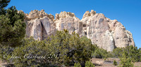
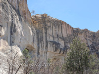
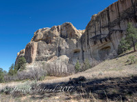
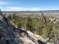
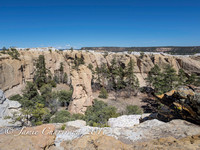
El Morro National Monument is located on an ancient east-west trail in western New Mexico. The main feature of this
National Monument is a great sandstone promontory with a pool of water at its base.
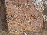
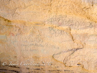
As a shaded oasis in the western U.S. desert, this site has seen many centuries of travelers. The remains of a mesa top pueblo are atop the promontory where between about 1275 to 1350 AD, up to 1500 people lived in this 875 room pueblo. The Spaniard explorers called it
El Morro (
The Headland). The
Zuni Indians call it "A'ts'ina" (
Place of writings on the rock). Anglo-Americans called it
Inscription Rock. Travelers left signatures, names, dates, and stories of their treks. While some of the inscriptions are fading, there are still many that can be seen today, some dating to the 17th century. Among the Anglo-American emigrants who left their names there in 1858 were several members of the
Rose-Baley Party, including
Leonard Rose and
John Udell.
[3] Some petroglyphs and carvings were made by the
Ancestral Puebloan centuries before Europeans started making their mark. In 1906, U.S. federal law prohibited further carving.
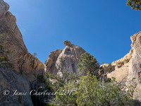
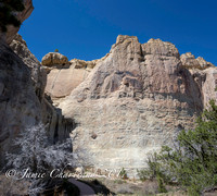
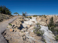
The many inscriptions, water pool, pueblo ruins, and top of the promontory are all accessible via park trails.
It is on the
Trails of the Ancients Byway, one of the designated
New Mexico Scenic Byways.
Source: Wikipedia
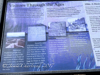
Imagine the comfort and refreshment of finding water after days of dusty travel. A reliable waterhole hidden at the base of a sandstone bluff made El Morro (the headland) a popular campsite for hundreds of years. Here, Ancestral Puebloans, Spanish and American travelers carved over 2,000 signatures, dates, messages, and petroglyphs.